It's that time of year, when the national agencies issue their predictions for the upcoming Atlantic Hurricane Season (and update any predictions they made earlier in the year). As June 1 approaches, marking the official start of the Atlantic hurricane season, communities along the coast are gearing up for what is forecasted to be an extraordinarily active season. Predictions from a number of the most authoritative meteorological agencies are setting the stage for a season that could surpass previous records in both frequency and intensity of hurricanes.
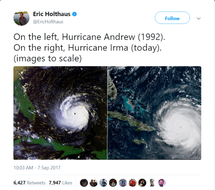
Historical Comparisons over the last forty years
Before we see what they're saying, consider what a typical Atlantic hurricane season looks like.
If you look at the 30 years from 1991 to 2020, an Atlantic hurricane season produces around 14 named storms (tropical storms), 7 hurricanes, and 3 major hurricanes, based on the average from 1991 to 2020. Those numbers have steadily increased over the decades. Without wading too much into the climate change debate, you can compare the numbers from the 80s, 90s, 00s, 10s, and the first part of the 2020s and see a big difference. The 1980s averaged 9 named storms, 5 hurricanes, and 1.5 major hurricanes a year. The 1990s bumped it up a little bit to 11 named storms, 6 hurricanes, and 2.5 major hurricanes. The 2000s averaged 15 named storms, 7 hurricanes, and 3.6 major hurricanes, while the 2010s were pretty close to those numbers. And for the last four years (2020-2023), we've been topping 21 named storms a year, 9 hurricanes and 4 major hurricanes. So if we don't think something is changing in the climate, just remember that we're seeing more than twice as many big storms now as we did forty years ago.
the Severity of the 2024 Forecast
Yet, the predictions for 2024 dwarf the typical numbers from the last thirty years. Experts from Colorado State University (CSU), the National Oceanic and Atmospheric Administration (NOAA), and other international weather organizations anticipate an "extremely active" hurricane season. CSU’s forecast is particularly striking, predicting 23 named storms, 11 hurricanes, and 5 major hurricanes with an accumulated cyclone energy (ACE) index of 210 units.
The ACE index is a measure of the total strength of a storm, looking at total wind speeds at different time intervals over the life of the named storm. Only 7 times since 1900 has the ACE index for a given year topped 200. So their predictions suggest not just more storms for the coming year, but more powerful and longer-lasting ones as well.
Key Drivers of the 2024 Hurricane Season
The expected increase in hurricane activity can be attributed to several interconnected atmospheric and oceanic conditions:
Above-Average Sea Surface Temperatures: The Atlantic Ocean has recorded higher-than-average temperatures, which are conducive to the development and strengthening of hurricanes. The effects of climate change? Perhaps.
La Niña Conditions: Forecasted to develop by summer, having a La Niña weather system in the Pacific is known to decrease wind shear over the Atlantic, which facilitates the formation and strengthening of hurricanes. Remember that wind shear describes air patterns where the wind changes directions horizontally and vertically. The more wind shear you have, the harder it is for storms to gather and stay together and grow into hurricanes. But it looks like we're going to have a weather system that has less wind shear, so it will be easier for major storms to form.
The Decline of El Niño: The ongoing El Niño is predicted to weaken by late summer, reducing the atmospheric conditions that typically disrupt hurricane development.
This combination of factors is reminiscent of conditions observed during the most active hurricane seasons in history, suggesting that 2024 could be a record-breaking year.
Preparedness: A Necessity for Coastal Communities
Given the heightened forecast for 2024, it is imperative for those in hurricane-prone areas to prepare thoroughly and well in advance of the peak months from August to October. Key preparatory actions include:
Emergency Response Planning: Ensure that all members of your household or organization understand their roles in an emergency. Regularly review and practice your emergency response plan.
Stocking Emergency Kits: Prepare kits that include at least three days’ supply of water and non-perishable food per person, medications, flashlights, batteries, first aid supplies, and copies of crucial documents in waterproof containers.
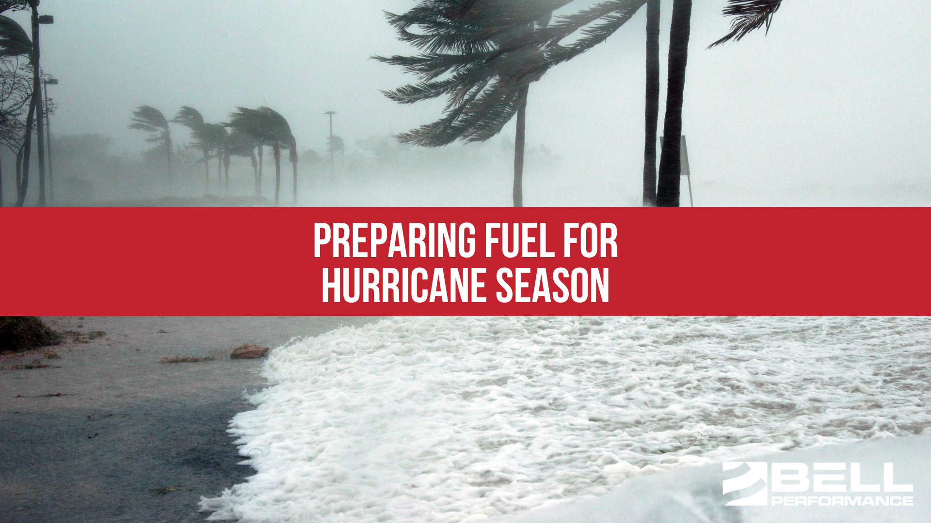
Check Your Stored Fuel: The best time to make sure your stored fuel is going to work when you need it is before you need it to. With hurricane season a month away, now is the time to make sure you don't have microbial contamination in your storage tank. If you don't have it (and it's best to confirm that through microbial testing), you've got enough time to use biocide to kill the contamination and clear the problem up.
Technological Advances in Hurricane Prediction and Monitoring
The accuracy of hurricane predictions has significantly improved over the years due to advancements in meteorological technology. Satellite technology, data modeling, and real-time analysis have enhanced our ability to track storm paths, predict hurricane development, and understand atmospheric conditions more comprehensively. These tools are crucial for providing timely warnings to populations at risk, allowing for better preparation and potentially saving lives.
Last Year Wasn't Bad. Maybe this will Make Up For It
The 2024 Atlantic hurricane season is projected to be one of the most active in history. Perhaps it's shaping up to be payback for last year, which was very active (23 storms) and yet not so bad (did any major storms make damaging landfall? We can't recall).
With forecasts predicting an unprecedented number of intense storms, preparation becomes more crucial than ever. By understanding the forecasts, recognizing the contributing factors, and taking informed and proactive steps toward preparedness, individuals and communities can significantly mitigate the impacts of what could be a record-setting hurricane season. The time to prepare is now—before the first storm is even named. Let’s stay vigilant, informed, and ready to act as the season progresses.